Showing posts with label Battle Maps. Show all posts

Sunday, June 25, 2023

Ensign DeBerniere'sMap of Bunker Hill


Ensign Henry DeBerniere as an officer in the 10th Regiment of Foot in 1775.  An enterprising officer with a talent for map making DeBerniere had undertaken spy missions in 1774 mapping routes out of Boston.  He took part on the 19 April mission to concord to destroy the supplies gathered there.  And he made a series if maps of Boston and the surrounding areas.  One of his best maps is of the Charlestown Peninsula and British troop movements during the Battle of Bunker Hill.


  There are a couple editions of this map on the internet.  This one is from Geography and Map Division Library of Congress ( G3764.B6S3 1775 .B3 Vault) and is an excellent copy.  The details of the map are outstanding and super useful to students if the battle or miniature wargamers wishing to refight the battle historically.


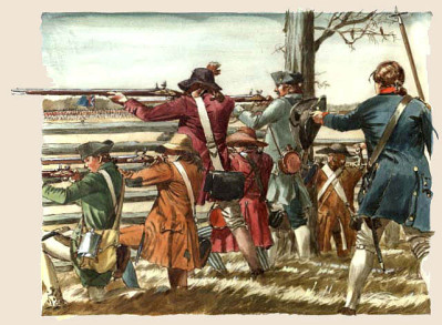
  This enlarged section showed the area where the Howe landed his main force at Moulton's point; sent his light Infantry companies along the beach to turn the American flank and the Grenadier attack against the rail fence.  The numerous fences slowed the British advance, and exposed them to small arms and cannon fire while trying to cross them.  The Royal Artillery could not cross the fields due to these fences so went a round them and got stuck in the wet marshy ground at the base of Breeds hill. The routes if the 5th and 52nd regiments during the third attack are clearly marked.


A close up of the Light Infantry companies on the beach trying toout flank the American position along the rail fence.  This area today is near the present Charlestown High school  and still has a sharp drop which obscure it from the ground.  The order of march for the light bobs are (from left to right) 23rd, 4th, 19th, 52nd, 43rd, 65th, 59th, 47th, 35th, 38th and 5th.


The final assault on the redoubt and breast work on Breeds hill. This is one of the very few maps which show how close Charlestown was to the hill and how snipers there effected earlier attacks.   It also points out the barn which had to be taken before the final attack on the redoubt.  Again fascinating details here like the extra flank companies position with the Marines and 47th regiments.


Sunday, March 15, 2020

‘Come on my brave Fusiliers!’ 15 March 1781


Guilford Courthouse 15 March 1781
Along the first line:

  " As at Camden, the British went forward as soon as they were in line. Captain Peter led the 23rd on as acting commanding officer, with the regiment effectively in two wings under captains Saumarez and Champagne. As they went forward, one of them noticed the ‘field lately ploughed, which was wet and muddy from the rains which had recently fallen’.


On they trudged towards the fence that marked the end of Hoskins’ cornfield and the beginning of the woods to the fore, observing as they grew closer that the rails were lined with men. MacLeod’s cannon opened fire, sending their ball whooshing into the American lines. Colonel Webster, on horseback, trotted to the front of his brigade and called out so that all could hear, ‘Charge!’ The men began jogging forward, bayonets fixed and muskets levelled towards the enemy. A crackling fire from their left, Kirkwood’s riflemen, began knocking down a redcoat here or there, but did nothing to check their impetus.


When the British line was little more than 50 yards from the North Carolina militia everything seemed to stop for Serjeant Lamb: … it was perceived the whole of their force had their arms presented, and resting on a rail fence … they were taking aim with the nicest precision. At this awful period a general pause took place; both parties surveyed each other for the moment with the most anxious suspense … Colonel Webster spurred his horse to the head of the 23rd and bellowed out, ‘Come on my brave Fusiliers!’ Some of the Americans started to run, but most held on for a moment; there was a rippling crash of American musketry when the redcoats were at optimum range, 40 to 50 yards away. Dozens of Webster’s men went down as the musket balls cut legs from under them or smashed into their chests. Lieutenant Calvert worried for an instant how his men might react to such a heavy fire: ‘They instantly returned it and did not give the enemy time to repeat their fire but rushed on them with bayonets.’ Captain Saumarez noted with pride, ‘No troops could behave better than the regiment … they never returned the enemy’s fire but by word of command and marched on with the most undaunted courage.’..."


Quote from;
Fusiliers:  The saga of a British Redcoat Regiment in the American Revolution  by Mark Urban


Saturday, January 12, 2019

Bird's Eye View Battle Maps


Battle of Bladensburg.

   Back when I was younger (1970's) one of my favorite books was the National Geographic History of the American Revolution.  It was not the text that grabbed me.  It was a quiant series about a family visiting battle fields at the correct  time of year as a fun family outing.  Something about the father in a coat and tie  struck me as off.  No it was the wonderful battle maps that still to this day hold my fascination.  These were bird eye views of the battlefield with soldiers fighting it out.  Incredibly detailed, they made the complicated actions understandable. They also made me run  to the local hobby story to buy boxes of Airfix soldiers and try and fight out these encounters.  These were one of the things which set me on my life long hobby of miniature  wargaming.

Since then I have wondered who  the artist was who did these works of art.  I also stumbled on similar works but with slightly different techniques.  Thankfully the internet has come to my assistance and I finally have some answers;  and evan more questions.  Here are the four artists who's battle maps have fascinated and inspired me.  In addition I will include blog and internet addresses of my sources so you know where I came about this information and who came up with this research.  It is important to give credit to those who did the work.


Bunker Hill

Richard Schlecht

   It was the work of Richard Schleht which first inspired me.  His original works appeared in the National Geographic book.  I still have the book.  Richard is still working and some of his art (including battle maps) can be found in the War of 1812 book,  "In Full Glory Reflected."

Breed's Hill redoubt

Fighting along the rail fence

Charlestown burning.


Fighting in Barber's Wheatfield
 2nd Saratoga
.

Balcarries Redoubt.

Breymann Redoubt.

Arnold at the Redoubt.


Battle of North Point.


   As an aside back when I worked for the National Park Service I did a research project for National Geographic.  They were happy with my work, but I had to decline the check they offered me for my work due to ethics laws.  Instead, they sent me as a present (which I could acept) a 8 x 10 copy of Richard Schlecht 's battle maps from the book.  These sit by my painting table.

Battle of Trenton.

American Artillery at Trenton


   More on Richard Schlecht and his life can be seen at  http://bdeemer.com/content/innercontent.php?id=27&bio=1


David Greenspan
   If you are a American Civil War buff you have seen David Greenspan 's battle maps. They were originally published by American Heritage in a general history written by Bruce Cantton.   These maps have been reprinted in a new book.  I have found little information about David Greenspan except that he died at a very early age. While most of his works are of American Civil War battkes, I have seen a few details of American Rev War works in the internet.  If anyone has more information about these, or know where the entire picture can be see please let me know.

A detail from his Battle of Saratoga.


For more information please see:
https://thehistoriansmanifesto.wordpress.com/2013/03/25/the-civil-war-maps-of-david-greenspan/

http://ilkleyoldschool.blogspot.com/2014/10/battle-maps.html
http://altefritz.blogspot.com/2018/04/the-best-maps-for-wargamers-ever.htm


Brian Kammerer
   Is a new artist who I think has taken the art to a new level. His works are only concerned with the American Civil War.  But he has improved on the art of his predecessors.  His work is brilliant.  He has done various stages of battles rather then the entire action at one go.  I can only hope that some day he can be persuaded to branch out to the American Rev War or War of 1812.
Please visit his web site at;
http://cwbattlemapart.com/CW-BMA-HomePage.html

Gerald Embelton
   Did the excellent battle map that serves as a header to this article.  It appears to be a one off and was done for the National Park Service.  If he has done more please let me know.


   So there you have it. All I have pulled together concerning this usual art.  Should anyone out there have any information or facts I have missed please write to me!  I hope you have enjoyed this trip down memory lane for me.