Showing posts with label Battlefield walk. Show all posts

Friday, February 19, 2021

Review of US Soldier vs British Soldier War of 1812


I received the Kindle edition of this Osprey series book.  There is not much out there on the North American War of 1812 in wargame circles. So when something comes out it is met with great rejoicing.  I saw this originally on the Osprey publishing website and pre ordered it right away.  I then spent the morning reading, and rereading it.  As someone who has limited dollars to spend on his hobby I have to say I was most happy with the book and think it well worth adding it to your library.


First off, what the book is not.  It is not a uniform guide.  It is not a history of the war.  There are other better books for those subjects.  Nor is it about the various Militia, Volunteer or Fencibels regiments.   

What it is is a comparison if the United States Regular soldier and his British counterpart.  It details their training, organization and background.  It goes into the drill manuals and how regiments formed up for battle.  There is some information about uniforms but just basics.  And there are three workman like accounts comparing the two armies at three major actions:  Queenstown Heights 1812, Chrysler's Farm 1813 and Chippewa 1814.  


The heart of the book is how the US regular army grew and developed during the war.  At the start the regular army was often the poor step child compared to the state militia.  Officers were often political appointed and ignorant of their duties.  There was no solid non commissioned ranks to train and maintain discipline and to be an example like in the British army.  Drill manuals?  Take your pick! Because there was no standard it was each regiment on its own.  As the war progress the incompetents are weeded out and a solid officer and non commissioned officer corp evolves.  A group of talented and dedicated officers rose to command positions.  The difference between the army at Queenstown and Chippewa was as light is to darkness.  


The book is not biased or one sided.  The British regular was a professional who maintained that reputation throughout the war.  The US regular evolved and developed throughout the war.  So yes, there is much more about him in the text and how this development came about.  Again the book is a comparison of the two regular soldiers from the start of the war to the end.  I think it is important to understand this before you buy the book.    I enjoyed it very much and found lots of good food for thought and lessons for my wargames armies.  


Saturday, January 12, 2019

Bird's Eye View Battle Maps


Battle of Bladensburg.

   Back when I was younger (1970's) one of my favorite books was the National Geographic History of the American Revolution.  It was not the text that grabbed me.  It was a quiant series about a family visiting battle fields at the correct  time of year as a fun family outing.  Something about the father in a coat and tie  struck me as off.  No it was the wonderful battle maps that still to this day hold my fascination.  These were bird eye views of the battlefield with soldiers fighting it out.  Incredibly detailed, they made the complicated actions understandable. They also made me run  to the local hobby story to buy boxes of Airfix soldiers and try and fight out these encounters.  These were one of the things which set me on my life long hobby of miniature  wargaming.

Since then I have wondered who  the artist was who did these works of art.  I also stumbled on similar works but with slightly different techniques.  Thankfully the internet has come to my assistance and I finally have some answers;  and evan more questions.  Here are the four artists who's battle maps have fascinated and inspired me.  In addition I will include blog and internet addresses of my sources so you know where I came about this information and who came up with this research.  It is important to give credit to those who did the work.


Bunker Hill

Richard Schlecht

   It was the work of Richard Schleht which first inspired me.  His original works appeared in the National Geographic book.  I still have the book.  Richard is still working and some of his art (including battle maps) can be found in the War of 1812 book,  "In Full Glory Reflected."

Breed's Hill redoubt

Fighting along the rail fence

Charlestown burning.


Fighting in Barber's Wheatfield
 2nd Saratoga
.

Balcarries Redoubt.

Breymann Redoubt.

Arnold at the Redoubt.


Battle of North Point.


   As an aside back when I worked for the National Park Service I did a research project for National Geographic.  They were happy with my work, but I had to decline the check they offered me for my work due to ethics laws.  Instead, they sent me as a present (which I could acept) a 8 x 10 copy of Richard Schlecht 's battle maps from the book.  These sit by my painting table.

Battle of Trenton.

American Artillery at Trenton


   More on Richard Schlecht and his life can be seen at  http://bdeemer.com/content/innercontent.php?id=27&bio=1


David Greenspan
   If you are a American Civil War buff you have seen David Greenspan 's battle maps. They were originally published by American Heritage in a general history written by Bruce Cantton.   These maps have been reprinted in a new book.  I have found little information about David Greenspan except that he died at a very early age. While most of his works are of American Civil War battkes, I have seen a few details of American Rev War works in the internet.  If anyone has more information about these, or know where the entire picture can be see please let me know.

A detail from his Battle of Saratoga.


For more information please see:
https://thehistoriansmanifesto.wordpress.com/2013/03/25/the-civil-war-maps-of-david-greenspan/

http://ilkleyoldschool.blogspot.com/2014/10/battle-maps.html
http://altefritz.blogspot.com/2018/04/the-best-maps-for-wargamers-ever.htm


Brian Kammerer
   Is a new artist who I think has taken the art to a new level. His works are only concerned with the American Civil War.  But he has improved on the art of his predecessors.  His work is brilliant.  He has done various stages of battles rather then the entire action at one go.  I can only hope that some day he can be persuaded to branch out to the American Rev War or War of 1812.
Please visit his web site at;
http://cwbattlemapart.com/CW-BMA-HomePage.html

Gerald Embelton
   Did the excellent battle map that serves as a header to this article.  It appears to be a one off and was done for the National Park Service.  If he has done more please let me know.


   So there you have it. All I have pulled together concerning this usual art.  Should anyone out there have any information or facts I have missed please write to me!  I hope you have enjoyed this trip down memory lane for me.


Thursday, January 10, 2019

The Battle of Princeton 1777


  I have gotten a number of comments about my new header.  It is a bird's eye view of the Battle of Princeton January 3, 1777.  The view is from the Princeton battlefield Society.  This is a friend's group who works to preserve the battlefield.  They do excellent work and have helped to preserve and increase the size of the battlefield.  If you would like to know more about them and the good work they do please follow this link:

https://www.theprincetonbattlefieldsociety.org

I really like these views of battlefields.  I have been gathering information and illustrations of other views similar to these for a future post here on the blog.

Wednesday, July 25, 2018

"I'll try sir!” A Visit to the Lundy’s Lane Battlefield, Niagara Falls, Canada


   If Chippawa is a battlefield preserved, Lundy's Lane is a battlefield lost—or at least obscured.  The urban sprawl of the modern day town of Niagara Falls has almost obliterated the battlefield.  Still, there are hidden nuggets to be found to reward a visitor searching for a link to the past.  After all, the history of one of the largest, deadliest and most confusing battles of the War of 1812, can still compel one to visit the site.


  Lundy's Lane Battlefield was a tourist tradition from about 1820 until 1865, in part because both Americans and Canadians claimed victory, contributing to its popularity.  Large observation towers were constructed and veterans from the battle served as guides.  After the American Civil War the appeal of visiting Lundy's Lane was eclipsed by more recent and vast battles in places like Gettysburg and Antietam.  The Lundy’s Lane observation towers were eventually torn down, which helped make room for attractions more familiar to us now.


   Today, it's almost like the town has become one giant theme park!  Because the battlefield is so built up, with a major roadway cutting across it, carrying buses and cars with people from all over the world to see the natural wonder of Niagara Falls. And all the tourist trappings such as wax museums, fast food places, parking lots, and souvenir shops, it takes some imagination to walk the land and picture how it was back in the summer of July 25, 1814. Thanks to the personal efforts of Miss Ruth Redmond, a schoolteacher, who bought up parcels to keep from development, at least some of the battlefield was saved.


Thank you Miss Ruth Redmond

  To help in your time travel,  I recommend you start with a visit at The Niagara History Museum, about two blocks down the road.  The very friendly Canadians there gave me an excellent walking tour map which is a must-have to visit the area.  In addition, the Museum has a succinct exhibit about the Battle of Lundy’s Lane and the War of 1812. There are uniforms, artifacts and stories about soldiers from each side.  A short audio visual presentation features reenactors in period uniforms.  Best of all there’s a hands-on opportunity to try on reproduction uniform coats and shakos from the 8th Regiment of Foot, and heft a reproduction musket.  It was great fun watching children (as well as a few adults!) enjoying these items.


   From the Museum you can walk up the road to Lundy’s Lane Battlefield as parking can be difficult.  Or, you can follow our lead and stop at the nearby Starbucks.  I got a head start, marching off, books and maps in hand to explore, while Janine parked and got us an iced coffee.  (Hey, if they had it, they would’ve used it!)

The Red painted meeting house on Drummond hill in 1814.

   After successfully navigating the onslaught of traffic, across the busy street I found the site of the Red Meeting House (which is still a church) and the cemetery (which has greatly expanded).  These landmarks allow one to mark out positions of the British line and American attacks with some accuracy.  


Looking from the British lines towards where Scott's brigade stood.

British artillery line was along the hill top.

Colonel Miller advanced under cover and fading light to overrun the gun line in this area.

Modern view of Miller over running and capturing the British artillery.

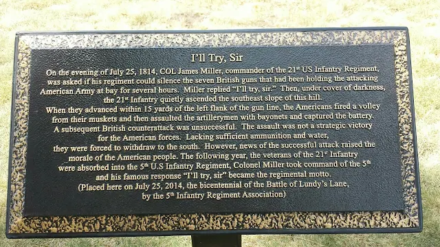
   My march across the paths to the southeast corner of the cemetery led me to find the area where American Colonel James Miller and his 21st US Infantry regiment surprised and captured the British artillery line.  His iconic answer when asked if he could capture the guns, "I'll try sir!" is the motto of the present day 5th Infantry Division. Examining the folds of the ground and imagining the fading light, I could better understand how he managed this.


Graves of Captain Hull and American soldiers.

  In the cemetery there are a number of markers and monuments.  As a resident of Massachusetts, I looked for and found the marker to Captain Abraham Hull of the 9th US Infantry regiment who was killed during the battle and buried on the field.  He was the son of General William Hull who surrendered Detroit and nephew of Commodore Isaac Hull of the USS Constitution.  With him are buried nineteen other American soldiers who were discovered in 1900 and reburied here.  There is always something moving and mysterious about the graves of unknown soldiers.


The battleground Hotel was not open the day we visited.

Area Drummond rallied his troops and launched assault to recapture the guns.  The American line was Montenegro of the hill.  Between these two groups Scott marched his brigade with ddisastrous results.


Modern rendition of fighting in this area.  British charging up hill to recapture the guns.  The Americans holdings hill top.   By this stage of the battle it was pitch black darkness.

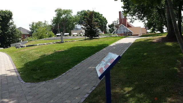
   On the Starbucks side is a park with waysides, markers and displays (along with the small Battle Ground Hotel Museum which was closed).  Walking down the slope I found where General Drummond rallied the British and Canadian forces to try and retake the captured cannon atop the hill.  It was near here, between the Americans on the top of the hill and the British on the lower slope where General Winfield Scott stumbled in the dark with the remnants of his brigade.  This was after dark and the fighting had been raging at point blank range.  Marching his brigade between the two antagonists in the pitch darkness his men were decimated by musket fire of friend and foe and he himself badly wounded.  Fighting in this area continued until just after midnight.  Exhausted, both sides withdrew ending the fighting.


   I enjoyed my visit very much and came away with a better impression of what happened during the battle.  I’d like to emphasize the value of a good map, as it will reward a visitor with a better understanding of this complicated and confusing battle, as well as sort through the modern day landscape for clues to what it once looked like.  I walked the field with A Crucible of Fire, by Robert Feltoe, which greatly assisted me.

   Thanks again to my dear wife, Janine, who accompanied me to Lundy’s Lane in 1985 when I scrambled up the side of the hill by a Seven Eleven because the cemetery gates were locked!  And returned again with me in 2018.  Thanks especially for enjoying the history with me, and editing this story! 

Thank you!


Tuesday, July 17, 2018

Visit to the Chippawa Battlefield, Chippawa Village Niagara Falls, Ontario Canada


  I have walked a number of battlefields. Some memorable, others very forgettable.  This one is very special to me.  It is very easy to imagine regiments marching across the fields here and even smell the black powder.  The field is small in comparison to such places as Gettysburg.  But as there is very little development, and what there is is screened by trees, it appears much bigger.  When I first stopped here in August 1985 there was only a single marker off the road.  Now there are walking paths and very good interpretive signage.


 The Battle of Chippawa was small in terms of the number of regiments.  The main fight on the "plain" was between three regular infantry battalions and an artillery battery on each side.  In the woods, militia, volunteers and Native Americans fought out a very different battle.  To me that is what makes it tactically intriguing.  It is easily imagined, easily understood because it is a smaller "playing field."  There are regulars facing off, the power of artillery and a deadly game of hide-and-seek in the woods.

  And it is the stuff of legend. General Winfield Scott had incurred the ire of The American War Department.  In consequence The War Department decided to send grey uniforms instead of the regulation blue uniforms.   The grey uniforms caused a short term case of mistaken identity by the British who assumed they were militia and anticipated an easy victory.  Observing the maneuvers as the troops advanced while under fire caused the British commander to exclaim, "Those are regulars, by God!"  Because of the American victory here West Point cadets wear grey today to honour this battle.  The stuff of legend!

Looking from American Artillery position near Ussher house towards British line.

Always important to know where you are!

Wood in distance was sure if fight between militia and Native Americans.

Looking towards Niagara river.  Site of Ussher farm house and lane.

Scott deployed his brigade along this lane from here to wood line in distance.
Same view as above but in 1814


  Today there is a marked entrance to the battlefield with a welcoming sign.  Plenty of parking spaces for buses and cars.  From the parking lot there is a short walk either across the field to the interpretation signage or along the river road past the old marker I saw in 1985.  The interpretive signage is set up along what would have been a farm lane in 1814 running from the river road, past the Ussher farm and towards the woods.  This is where is American 1st Brigade under Winfield Scott deployed into line.  Across the field in front of you was where the British line deployed.  Here in the actual field you notice that while there is plenty of room for Scott to deploy his artillery and three battalions in line, his British counterpart has room to deploy only two battalions and artillery, with his third battalion in reserve.  One of the advantages of actually visiting a battlefield is that you can  understand clearly how things happened.  Looking towards the woods you appreciate how much room they  needed to maneuver battalions even on this small scale.  The interpretive signs should be read from left to right and do a very good job of setting the stage of why this battle was fought and then how it was fought.

With maps and books in hand I follow the course of the battle.

Pointing towards Street's Creek where Scott's brigade crossed and then deployed into line.

  How they would have looked.

   In the center of the field, just behind the signage is a memorial cairn which has memorial tablets to all sides who fought here.  British/Canadian and American regiments and batteries are listed, and there is a memorial tablet to the Native Americans who fought on both sides.  Lastly a tablet that mentions that since this "unpleasantness" America and Canada have enjoyed over two hundred years of peace as neighbors. That is a nice thought to take with you as you leave.


  Thank you to my wife Janine for visiting this battlefield in both 1985 (during our honeymoon), again in 2018, and for editing this posting.