In observance of the events of April 19, 1775 I thought I would post a few pictures of sites associated with the fighting that day.

The North Bridge in Concord.
 |
| North Bridge fight Concord By Don Troiani. |
 |
| North Bridge from The British side. |
 |
| View of the bridge from the Americans marching down the hill |
Merriam's Corner Concord. This was about a mile east of Concord and here was the start of the local Minute and Militia companies harassing the British on their return to Boston.
 |
| Merriam corner from 1890's |
 |
| Merriam House. The Reading company of Militia under John Brooks took cover by the house and fired at the British in the road. |
 |
| View from the road. The British March column was looking towards Merriam house |
As the British defended a steep hill east of Concord the road turned sharply to the North before again turning sharply to the east. Here, at the "Bloody Angle" in Lincoln the British were caught between two large groups of minute and militia companies. Due to the unusually heavy woods they could not deploy flankers. The Road here has been closed to traffic and restored to its 18th century appearance.
 |
| "Bloody Angle" |
 |
| "Bloody Angle" British column caught between groups of militia on both sides of the road. |
 |
| stone walls lined the road. |
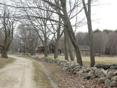 |
| Hartwell Tavern area |
 |
| Illustration of fighting in above area. |
Lastly, since almost everyone has hear about the Midnight Ride of Paul Revere here is the area where he was captured by British officers in the way to Concord
 |
| Paul Revere capture site 1890's |
 |
| Site today |
On Lexington green that morning The first shots of the day were fired. The green today is almost unrecognizable from its 1775 appearance.
 |
| Lexington Green 1775 |
 |
| The Green today |
Later that day Captain John Parker took his company of Lexington militia to fight The British as they returned to Boston. He placed his men on a steep hillside looking down along the road where a small bridge crossed a shallow stream.
 |
| View from the British column towards area Captain Parker deployed his company. |
Thanks for sharing Mark, great post so beautifully illustrated...
ReplyDeleteThank you!
DeleteVery helpful, I always find woods density pictures interesting from the perspective of how terrain should or should not block vision.
ReplyDeleteYes it is interesting. One of the perks of battlefield walks.
DeleteAn important date in the history of your nation Mark, and one worthy of mention on your blog.
ReplyDeleteI am glad you enjoyed it. Stuck inside the house it gave me a virtual trip down memory lane.
DeleteExcellent resources from an expert on the subject. Thanks Mark!
ReplyDeleteThank you AJ. I did a tour of the Battle Road after the TriCon convention years ago. I still get gamers who were there saying how much they enjoyed it. I am more then willing to do so again if people or individuals are interested.
Delete